


ASCENSORES VALPARAISO
Comission: SCL2110, Santiago Biennial 2010
Artistic Director: Rodrigo Tisi
Location: Valparaiso, Santiago, Chile
Design: 2010
Project Architect: Gia Wolff
The Ascensores Valparaiso proposal envisions a new use of the existing funicular system in which the axis of the various cable cars are extended to reconnect the higher informal city of the ‘cerros’ (hilltops) to the lower formal city and to the water. Each extended line is then expanded in order to outline different proposed activity zones that develop out from the funicular axis to engage the larger urban territory.
The project operates at several different levels - urban planning and zoning, architecture, industrial design, graphics and mapping. The different modes are interconnected and have been developed as such, moving continuously through the different scales and linking approaches and strategies in a conceptually energetic manner.
The final project reflects these multiple aspects - consolidating the urban re-planning of the existing funiculars throughout the city, to the midscale of the proposed reactivation of the Espiritu Santo axis as a sort of infrastructural 3D zoning, to the intervention on the cubicle of the cable car itself, to the production of a AscensoresValparaiso’s map - not unlike the subway/underground maps of a large metropolis.
The proposal is framed within a larger ambition for reimagining the city of Valparaiso, which until the 1914 opening of the Panama Canal was the most important port on the South Pacific coast. The new infrastructure responds to the current post-earthquake status with a significant revitalization plan that, starting from the very particular existing network of funiculars, aims at a larger urban regeneration through the injection of new activities, new energy, storm-water management and an integrated circulation to favor public space and a new pedestrian experience.
Step 1: the MAP
The design of the AscensoresValparaiso’s map (AV_map) is both a productive reading of the existing funicular infrastructure as well as a tool for the city and its development – for residents, students and tourists alike.
Each existing cable car is recorded and color-coded, its axis stretched out in two directions to reach both the hilltop informal developments above and the water below – now inaccesible because of the industrial port. The AV_map back shows the colored funicular lines and their intersection with existing relevant public functions within the city.
Step 2: the VISION
The colored lines – no longer only a graphic tool – are axes that cross the complex city topography as an infrastructure of light, energy, water management and circulation for a new city experience.
Step 3: the LINES
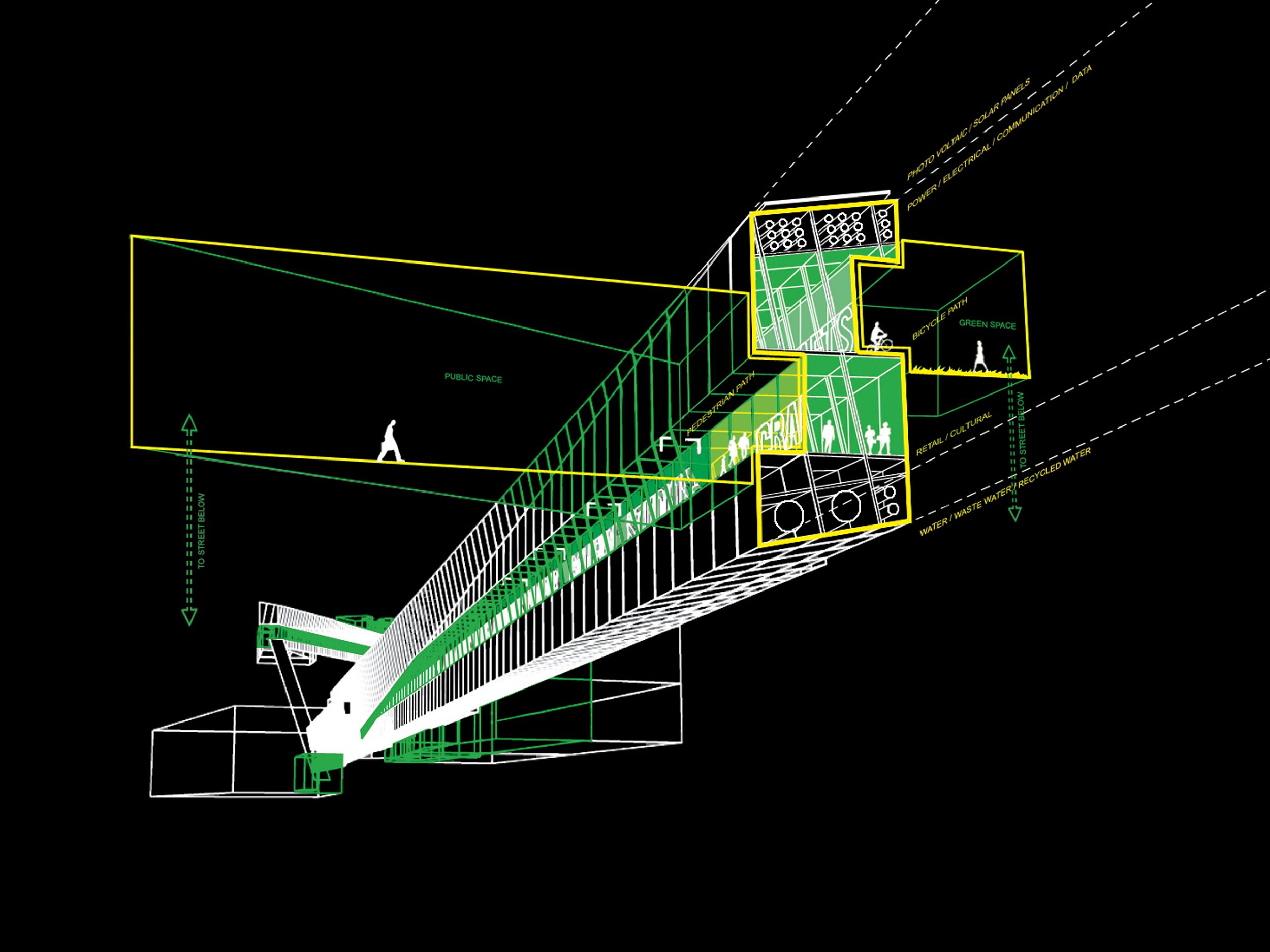
The colored lines are made up of a combination of: pedestrian circulation, bikes, skates and wheelchairs’ paths, collection and drainage of storm water from the hilltops, and solar-powered lighting throughout. They engage the juxtaposition in the urban fabric, intertwining and interacting with the administrative monumental city on the flat land as well as with the pixelated small-scale dense inhabitation that covers the hills.
Step 4: the FIELDS
The color lines expand to become color fields. New programs are inserted in and overlayed on the existing urban fabric. The adjacency between the old and new creates opportunities for a new experience of Valparaiso. As extensions of the existing ascensores’ infrastructure, which was widely distributed on the city terrain in the early 1900 to mitigate its steep topography, the fields propose a way to reactivate the ascensores with a new purpose beyond transportation.
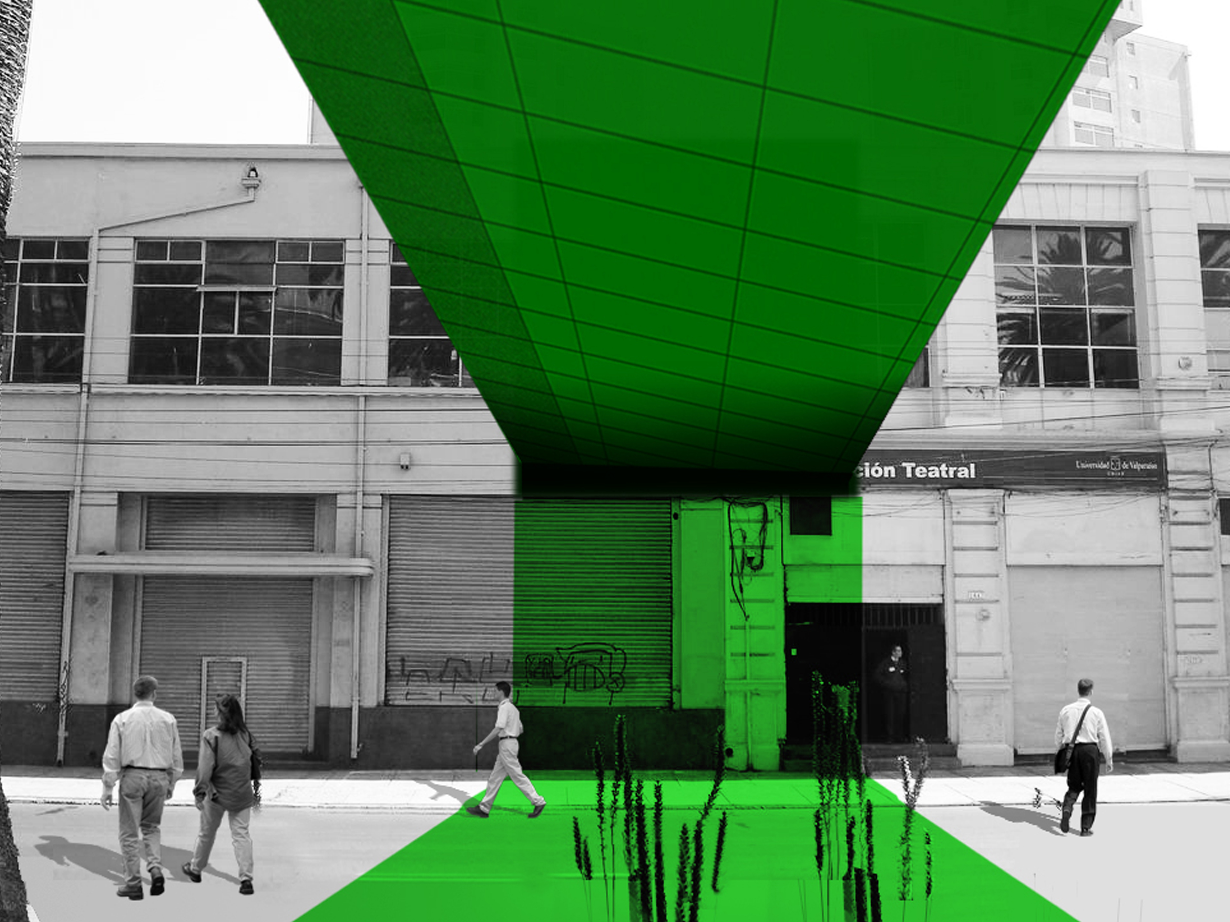
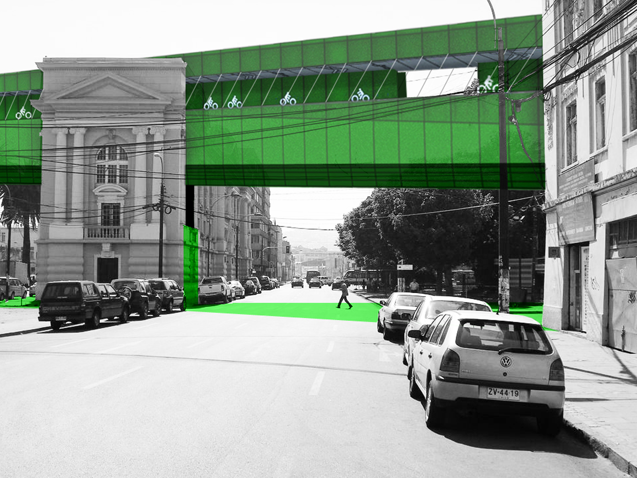
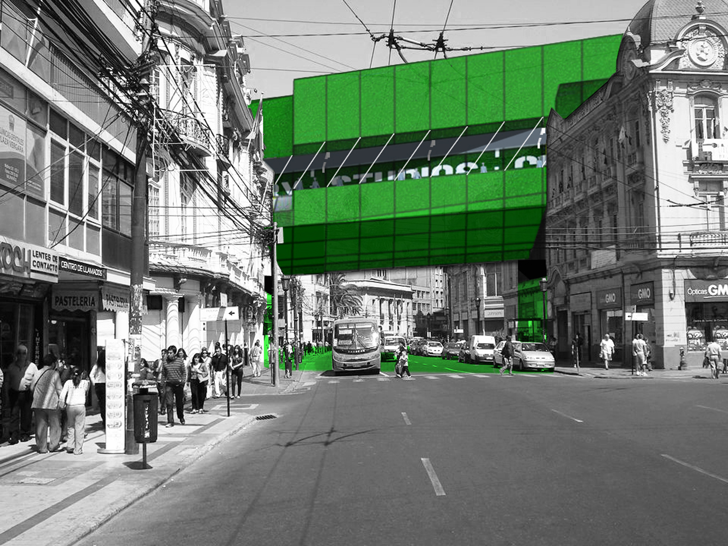
Step 5: the ASCENSOR ESPIRITU SANTO
The funicular Espiritu Santo was selected for its central location to test the interaction of the proposal with a selection of the existing public spaces and buildings within Valparaiso, such as Plaza Victoria, the Santiago Library and the La Sebastiana Museum.
The green axis of the funicular has been extruded into a physical linear volume that crosses the city, its open spaces and its built fabric adjusting to different heights at different points. Along this volume, retail and culture fill the space contained between the pedestrian and bike paths. The moments of intersection with the existing buildings are reconfigured as new public spaces, generating opportunities for program exchange as well as vertical circulation to link the elevated public space to the city at ground level.
The ascensor is a switch point along the color field. As both the generator and the glitch within the inhabitable map, the two up-and-down ascensor cabins are conceived as a single box split in two, with the split faces being the only glazed façades skinning an otherwise mute box. Refocusing the experience of the ride from the mere view of the panorama toward the encounter with the car’s opposite half – which happens only once at the mid-point of the climb - the ascensor’s journey is centered on the people’s face-to-face interaction (and its expectation) as they go up or down along the track experiencing this ingenious early engineering industrial infrastructure.
The two terminal ends of the Espiritu Santo green band are look-out points as well as physical connections and access points to the city. On the hills, the view is toward the areas of continuous expansion of the city and the adjacent cerros. At the water, the connection is with the waterfront – currently severed by the left-over fabric of the industrial port – and the openness of the Pacific Ocean.
Learn more: